Embedding & Sharing
GeoLibre's browser build can be embedded in any web page and configured through URL query parameters. This is how you turn a shared project into a live, focused map for a website, a report, or a dashboard.
The live viewer
The browser build is hosted at https://web.geolibre.app/. It is a static site deployed on GitHub Pages that runs entirely in your browser: it has no analytics and no server account, and the data you load is processed client-side. Data leaves your browser only when you add a remote URL or explicitly share a project.
Open a public project by passing its .geolibre.json URL with the url parameter:
https://web.geolibre.app/?url=https://share.geolibre.app/giswqs/3d-tiles.geolibre.json
A project URL like this comes from Project → Share. See Projects.
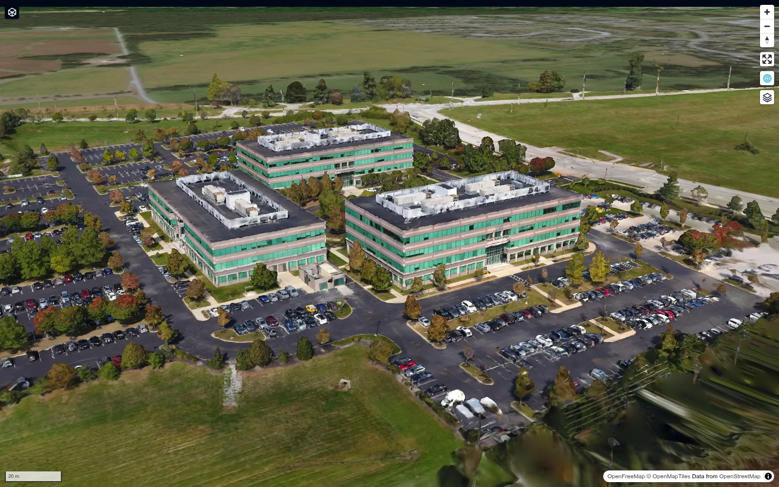
A chrome-free maponly embed shows only the map, as in this shared 3D Tiles project:
URL parameters
| Parameter | Example | Description |
|---|---|---|
url |
url=https://share.geolibre.app/you/project.geolibre.json |
Loads a .geolibre.json project from a public URL. |
layout |
layout=compact |
Compact embed layout: icon-only toolbar buttons and hidden project metadata. embed and iframe are aliases. |
toolbar |
toolbar=icons |
Icon-only toolbar buttons without the full compact layout. icon and icon-only are aliases. |
panels |
panels=none |
Hides the Layers, Style, and Attribute table panels. hidden, hide, and off are aliases. |
hidePanels |
hidePanels=true |
Alternative way to hide those panels. |
maponly |
maponly |
Hides all chrome (toolbar, panels, and status bar), leaving only the map. The bare flag or true, 1, yes, on enable it. |
welcome |
welcome=0 |
Hides the first-launch welcome wizard. Accepts 0, false, off, or no. A url= deep link already suppresses it automatically. |
theme |
theme=dark |
Sets the initial color theme, overriding the OS preference. Accepts dark or light; the in-app toggle still works afterward. |
tool |
tool=adaptive_filter |
Opens the Processing (Whitebox toolbox) dialog on a specific tool by its id. Unknown ids open the dialog without preselecting a tool. |
Parameters combine. For a narrow, chrome-free, dark embed of a shared project:
https://web.geolibre.app/?url=https://share.geolibre.app/you/project.geolibre.json&maponly&theme=dark
Deep-linking a Processing tool
tool=<id> opens the Processing (Whitebox toolbox) dialog preselected to a tool.
Any additional query parameters pre-fill that tool's form, using the tool's
own parameter names, so a link can arrive ready to run:
https://web.geolibre.app/?tool=extract_cog_subset&url=https%3A%2F%2Fdata.source.coop%2Fgiswqs%2Fopengeos%2Fdem.tif&bbox_crs=4326
When tool= is present the app is in tool mode: url names a tool input
(here, the COG to subset) rather than a project to load, so the project loader
stands down. App/embed parameters above (theme, layout, panels, maponly,
locale, …) keep their own meaning and are never passed to the tool.
Preselection and parameter prefilling apply only to an id that matches the
Processing menu: an id not in the menu still opens the dialog, but without
preselecting a tool or applying any parameters. A known id the current engine
doesn't expose (WASM in the browser, the Python sidecar on desktop) likewise
isn't preselected. Tool ids match the Processing menu — the same ids used across
the Whitebox toolbox.
Embedding in a page
Drop the viewer into an <iframe>:
<iframe
src="https://web.geolibre.app/?url=https://share.geolibre.app/you/project.geolibre.json&maponly"
title="GeoLibre map"
width="100%"
height="600"
style="border: 0;"
loading="lazy"
allow="fullscreen; geolocation"
></iframe>
Use layout=compact when you want a slim toolbar to remain (for example, so viewers can switch basemaps), or maponly for a pure map.
Talking to the map at runtime
URL parameters configure the app once, at load. To keep talking to a live
embed (fly to the record the user just clicked in your app, highlight it, open a
processing tool) and to hear what the user does inside the map, use the embed
postMessage API.
Enabling it
The API is off by default: a public deployment can never be driven by the page that frames it. Turn it on by naming the origins you trust. For the Docker image, that is one environment variable:
docker run --rm -p 8080:80 \
  -e GEOLIBRE_EMBED_ORIGINS="https://portal.example.com,https://erp.example.com" \
  ghcr.io/opengeos/geolibre:latest
For a static build, bake it in instead:
VITE_GEOLIBRE_EMBED_ORIGINS="https://portal.example.com" npm run build.
Entries are origins (scheme://host[:port]); a trailing path is ignored. *
allows any origin and is only appropriate on a private network. The allowlist is
enforced in both directions: a message from an unlisted origin is ignored, and
every message the app sends is addressed to a listed origin. (With *
configured, outbound messages are addressed to * until the host's first
message identifies it, which is one more reason to name your origins.)
Setting the allowlist also narrows the ?embed=1 project/scripting bridges (used
by the Python package) to the same origins. As extra hardening
you can stop other sites from framing the app at all by adding
Content-Security-Policy: frame-ancestors <your origins> at your reverse proxy.
Message shape
Every message, in both directions, is versioned:
{ "v": 1, "type": "setView", "payload": { "center": [-95.7, 37.1], "zoom": 5 } }
Messages the app sends also carry "source": "geolibre", so you can filter
them out of the other postMessage traffic on your page.
Host to GeoLibre
| Type | Payload | Effect |
|---|---|---|
loadProject |
{ url } |
Loads a .geolibre.json project without reloading the iframe. |
setView |
{ bbox } or { center, zoom, bearing, pitch, duration } |
Fits a bounding box, or flies the camera to the properties you send. |
highlightFeature |
{ layerId, featureId \| featureIds \| filter, fit } |
Selects and highlights features; filter matches properties. fit zooms to them. |
openTool |
{ id, params } |
Opens the Processing dialog on a tool, pre-filling params. Runtime twin of ?tool=. |
Send { layerId } alone to highlightFeature to clear the highlight. A request
that names features (or a filter) but matches none is rejected rather than
treated as a clear, so a mistyped id does not silently wipe the user's selection.
Highlighting reads the layer's features from the project, so it applies to vector
layers GeoLibre holds as GeoJSON, not to ones whose features live only in a tile
source.
Add a requestId to any message and the app answers with an ack (below)
reporting whether it worked.
GeoLibre to host
| Type | Payload | Fires when |
|---|---|---|
ready |
{ version } |
The app has mounted and is listening. |
ack |
{ requestId, ok, error } |
A message you sent with a requestId was applied (or rejected). |
projectLoaded |
{ url, name, layerIds } |
A project finished loading, whoever started it. |
selectionChanged |
{ layerId, featureIds } |
The user (or your highlightFeature) changed the selection. |
viewChanged |
{ bbox, center, zoom, bearing, pitch } |
The camera moved (throttled to about four events a second). |
toolCompleted |
{ id, name, status, engine, durationMs, outputLayerNames } |
A processing run finished, successfully or not. |
serverFileWritten |
{ path, toolId } |
A file-based tool wrote an output (conversion and raster tools). |
A host page
<iframe
  id="map"
  src="https://gis.example.com/?url=https://erp.example.com/fields.geolibre.json&maponly"
  title="GeoLibre map"
  width="100%"
  height="600"
  style="border: 0"
></iframe>

<script>
  const frame = document.getElementById("map");
  const APP_ORIGIN = "https://gis.example.com";

  const send = (type, payload) =>
    frame.contentWindow.postMessage({ v: 1, type, payload }, APP_ORIGIN);

  window.addEventListener("message", (event) => {
    if (event.origin !== APP_ORIGIN) return;
    const message = event.data;
    if (message?.source !== "geolibre" || message.v !== 1) return;

    if (message.type === "ready") {
      // Safe to start sending commands.
    } else if (message.type === "selectionChanged") {
      showRecordFor(message.payload.featureIds[0]);
    }
  });

  // Click a record in your own UI: fly to it and highlight it, no reload.
  function focusField(field) {
    send("setView", { bbox: field.bbox });
    send("highlightFeature", {
      layerId: "fields",
      filter: { parcel_id: field.id },
      fit: true,
    });
  }
</script>
Wait for ready before sending: messages that arrive before the app has mounted
are not queued. Treat ready as idempotent, since it is re-sent whenever the app
remounts (a navigation inside the frame, a development hot reload).
What works in an embed
The browser build supports map navigation, browser-selected and URL-based data, styling, the SQL Workspace, and most plugins. Desktop-only features (local file dialogs, local MBTiles and raster reads, project save/open, and the Python sidecar tools) are not available in an embed. See Getting Started.
See the Sharing & Embedding tutorial for a full walkthrough.